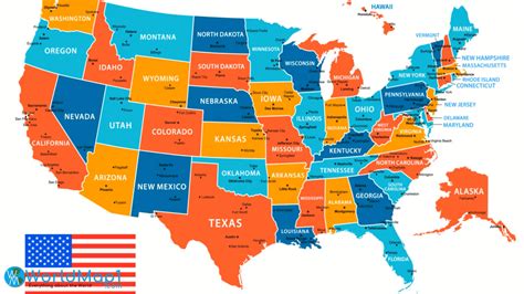
The Map Of The United States

The map of the United States is a complex and fascinating representation of the country’s geography, history, and cultural identity. Spanning across North America, the United States is a vast and diverse nation, comprising 50 states, numerous territories, and a multitude of cities, towns, and landscapes. From the sun-kissed beaches of California to the majestic mountains of Colorado, and from the bustling streets of New York City to the historic charm of New Orleans, the map of the United States is a treasure trove of exciting destinations and experiences.
Geographical Overview

The United States is bounded by the Atlantic Ocean to the east, the Pacific Ocean to the west, and the Arctic Ocean to the northwest. The country shares international borders with Canada to the north and Mexico to the south. The geographical landscape of the United States is incredibly varied, featuring expansive plains, towering mountain ranges, and scenic coastlines. The Appalachian Mountains, the Rocky Mountains, and the Sierra Nevada are just a few of the notable mountain ranges that crisscross the country. The Great Plains, the Great Basin, and the Gulf Coast are some of the prominent geographical regions that shape the nation’s landscape.
Key Points
- The United States is the third-largest country in the world by land area, covering approximately 3.8 million square miles.
- The country has a diverse range of climates, including tropical, desert, temperate, and polar regions.
- The Appalachian Mountains are one of the oldest mountain ranges in North America, stretching over 2,400 miles from Canada to Alabama.
- The Grand Canyon, located in Arizona, is one of the most iconic natural wonders in the United States, measuring 277 miles long, up to 18 miles wide, and over a mile deep.
- The Mississippi River, which flows through the heart of the country, is the second-longest river in North America, stretching approximately 2,320 miles from its source to the Gulf of Mexico.
Regional Divisions
The United States can be broadly divided into several distinct regions, each with its unique cultural, historical, and geographical characteristics. The Northeast region, comprising states such as New York, Massachusetts, and Pennsylvania, is known for its rich history, vibrant cities, and picturesque coastline. The South, which includes states such as Texas, Florida, and Georgia, is famous for its warm climate, beautiful beaches, and rich musical heritage. The Midwest, often referred to as the “heartland” of America, is characterized by its rolling plains, scenic lakes, and bustling cities like Chicago and Detroit. The West Coast, which includes states such as California, Oregon, and Washington, is renowned for its stunning natural beauty, vibrant cities, and thriving tech industry.| Region | States | Population (2020 estimate) |
|---|---|---|
| Northeast | 9 states (including New York, Massachusetts, and Pennsylvania) | approximately 55.9 million |
| South | 16 states (including Texas, Florida, and Georgia) | approximately 126.4 million |
| Midwest | 12 states (including Illinois, Michigan, and Ohio) | approximately 68.4 million |
| West Coast | 3 states (including California, Oregon, and Washington) | approximately 53.1 million |

Historical Significance

The map of the United States is also a testament to the country’s complex and often tumultuous history. From the early Native American settlements to the European colonization, the American Revolution, and the Civil War, the United States has undergone significant transformations that have shaped its identity and geography. The Louisiana Purchase of 1803, the Mexican-American War, and the construction of the Transcontinental Railroad are just a few examples of the pivotal events that have expanded the country’s borders and influenced its development.
Cultural Identity
The United States is a melting pot of cultures, with people from diverse backgrounds and ethnicities contributing to its rich cultural heritage. From the iconic music genres of jazz, blues, and country to the vibrant arts scene, delicious cuisine, and exciting festivals, the map of the United States is a reflection of the country’s incredible cultural diversity. The Statue of Liberty, the Golden Gate Bridge, and the Grand Canyon are just a few of the many iconic landmarks that symbolize American culture and identity.As the United States continues to evolve and grow, its map remains an essential tool for understanding the country's complex geography, history, and cultural identity. Whether you're a native American or an international visitor, exploring the map of the United States is an exciting adventure that promises to reveal new insights, hidden gems, and unforgettable experiences.
What is the largest state in the United States by land area?
+Alaska is the largest state in the United States, covering approximately 663,300 square miles.
Which river is the longest in the United States?
+The Missouri River is the longest river in the United States, stretching approximately 2,540 miles from its source to its confluence with the Mississippi River.
What is the most populous city in the United States?
+New York City is the most populous city in the United States, with a population of over 8.4 million people.
Meta Description: Explore the fascinating map of the United States, discovering its diverse geography, rich history, and vibrant cultural identity. Learn about the country’s regional divisions, historical significance, and iconic landmarks.


